I’ve found over my many years of travel that there are three kinds of people one encounters after returning from a trip. Generally everyone will ask how your trip was – but this disguises their interest level. Launching into an answer requires a sense of what they really expected.
First is the “elevator ride response”: this group, in truth, want a brief overview, sufficient to hear in the short ride of one or two minutes before the elevator door opens and they escape. Minutia is out; broad themes are in.
Then there is the “cautiously interested”. This group often includes those who have travelled where you have, or seriously intend to do so. Their intentions are honourable but their attention span not so committed. Five to ten minutes will do it, particularly if accompanied by a few photographs.
Then there is the “curious, inquisitive traveller” who has tolerance for detail and some nuance. They are not to be taken advantage of, though, as everyone has their limit – and that upper limit is gradually diminishing. Photos are obligatory, along with colourful anecdotes.
This blog is for you if you are in the third group. Plus if you would like a broader selection of photos go to: https://photos.app.goo.gl/7aRBQJgpuuB7ciXW7
So what was our itinerary and what were the distinctive features of Icelandic people, culture, geography and weather?
Before the cruise:
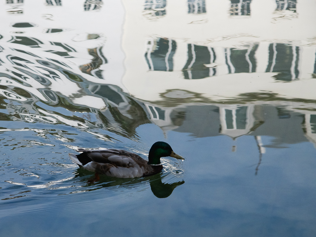
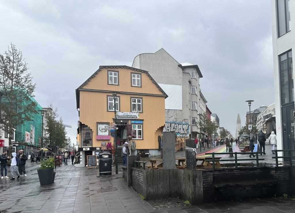
The first four days Penny and I winged it. We arrived in the capital city, Reykjavik, on July 1 after a five hour overnight flight from Toronto (and four hour time difference). The $225 taxi ride into town foretold an expensive country. The city of 200,000 has almost 60% of the country’s population, and it’s the worlds smallest capital. We cased the city: it’s clean, colourful, modern, somewhat hilly, has coffee shops within bookstores, museums, creative street art and ducks swimming in their fountains.
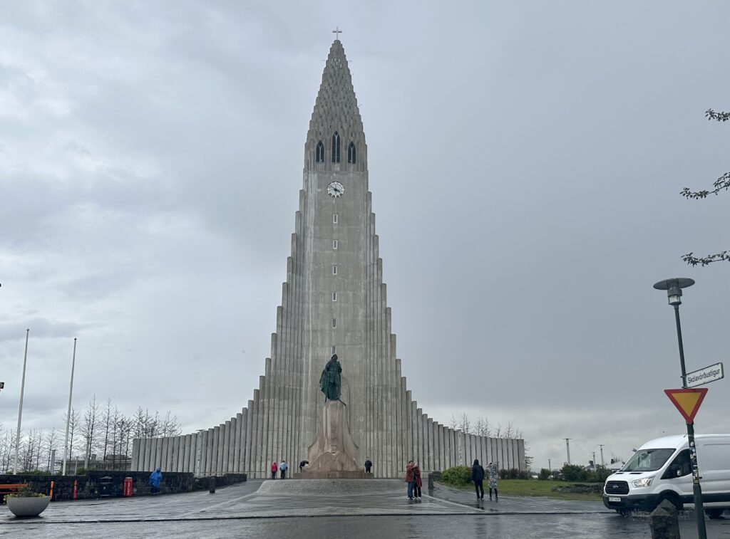
We finished our first walk at a very tall (245’) Lutheran Church, called Hallgrimskirkja, with a distinctive curved spine and side wings. The wings and steeple were inspired by the famous cliffs of basalt columns found along Iceland’s south coast and resemble a gigantic stalagmite of petrified lava residue. It has a 25-ton, 50 foot tall pipe organ made from 5,275 pipes.
Both an excellent lunch (Apotek) and dinner (Saeta Svinia) underscored the reality that every meal we consumed in this city was a delight. One other day we ate at the Fish Company, consuming a soup of lobster and other gems, oysters on the half shell and a 14 piece sushi dinner.
The next day we took a special 11 hour tour. We had lots of light; this time of year at Iceland’s latitude the sun rises at 3 am and sets at midnight! This tour encapsulated what we were about to experience over the next two weeks:
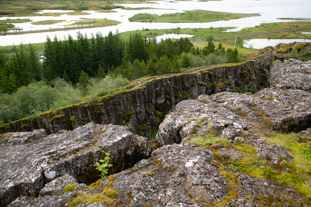
1. Thingvellir National Park: The park is the original location of the world’s longest running and still ongoing parliament (formed in 930 AD and said to be the founding of the nation of Iceland).
But it’s most fascinating for its geology. Iceland is divided by the Mid-Atlantic Rift; some parts of it, such as the Westfjords and Reyjavik, are on the North American tectonic plate, while others, such as Vatnajokull glacier and the East Fjords, are on the Eurasian plate. Iceland is the only place in the world where this rift is above sea-level, and nowhere can you see the edges of both plates as clearly as in Thingvellir. The faults and fissures of the area make evident the lifting of the earth’s crust. During the last glacial period, a layer of ice, more than a 1,000 metres thick, covered the land.
We walked down into and through the Almannagjá gorge (a big crack or fault that traverses the area) past a charming waterfall called Öxarárfoss. The area is now a UNESCO World Heritage Site.
2. Geothermal Baths: We next stopped at a geothermal spa area, called Laugarvatn Fontana. Hot geothermal springs run under the lake heating the ground all around the lake. A man was cooking rye bread in a pot under the hot sands at the lake edge.
3. Strokkur geyser: In an area called Blaskogabyggo (note the 13 letters – I’ll get to this in my wrap-up) in Iceland’s Haukadalur valley, a high temperature geothermal area (base temperature around 250 degrees C). We hiked up to where the geyser Strokkur was blasting off every 5 to 6 minutes. The original “Geysir” (from which we get the term geyser) has stopped producing and now only erupts after earthquakes. Strokkur is today’s biggest draw thanks to its impressively frequent eruptions.
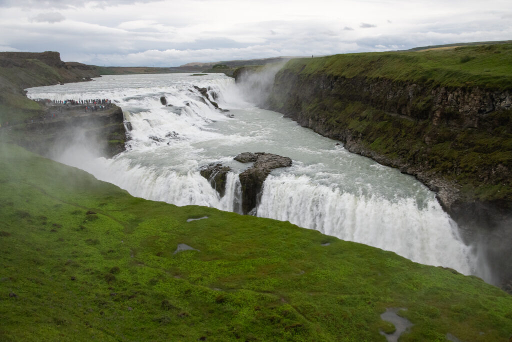
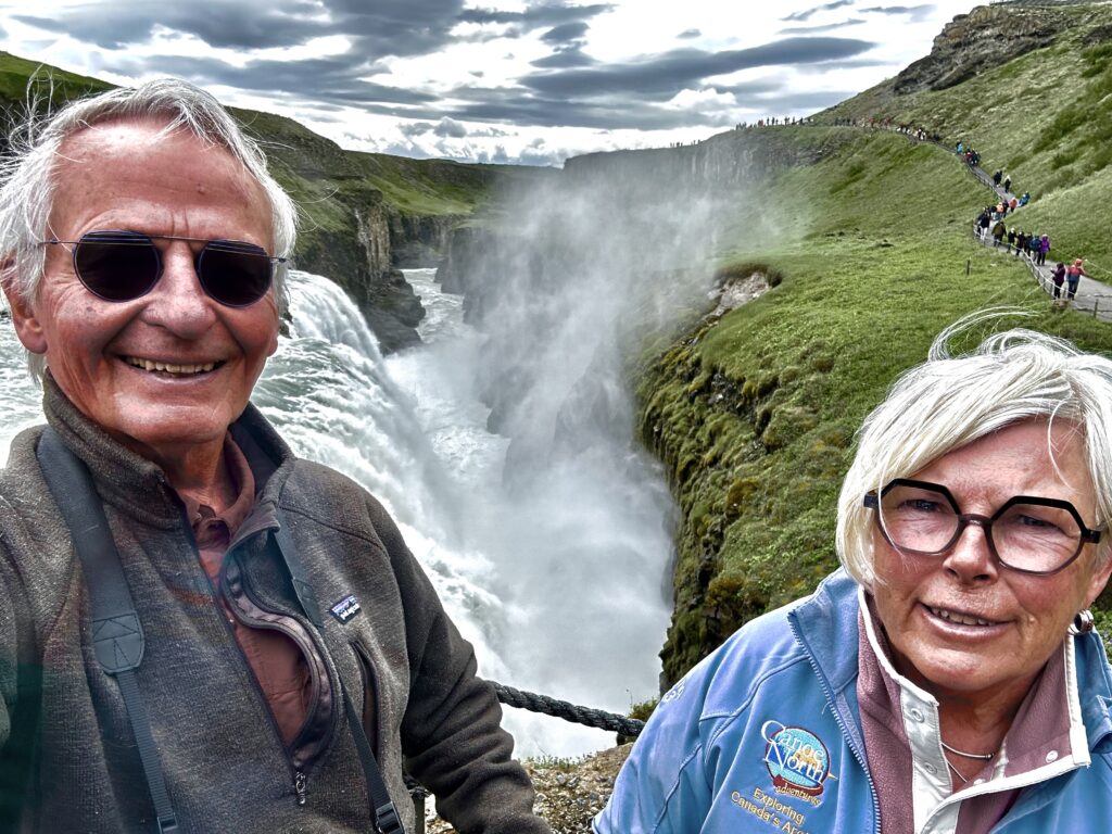
4. Golden Falls (Gullfoss): is a dramatic display of water from a glacier upstream flowing down the Hvita River and cascading 105 feet over two stages, with canyon walls rising 230 feet. The crevice the river flows through is quite narrow (66 feet) and extends perpendicular to the flow of the river – making this quite a dramatic sight. All formed by glacial outbursts at the beginning of the last ice age.
5. Sheep farm: we stopped at this farm where sheep were roaming and ventured into the barn to see them up close. We learned that the country has more sheep than people.
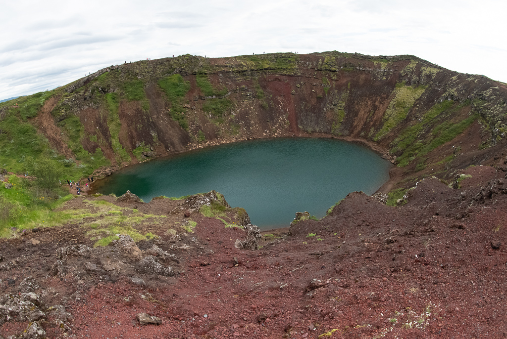
6. Kerid Crater: is a volcanic crater lake; the caldera is 180 ft deep; it’s 560 ft wide and 890 ft across. The red volcanic rock was distinctive. The shallow lake at the bottom was a vivid aquamarine.
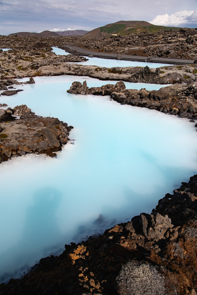
7. The Blue Lagoon, one of the 25 Wonders of the World. It’s a huge geothermal seawater spa, of a soft blue colour from the silica suspended in the water. We soaked there for two and a half hours, then consumed two glasses of Prosecco and two bags of chips for $80.
Other days brought unique curiosities such as the famous Icelandic Phallological Museum (more commonly known as the Penis Museum). It was a standout of curious tidbits. I succumbed to the purchase of a T shirt. Its website is: www.phallus.is.
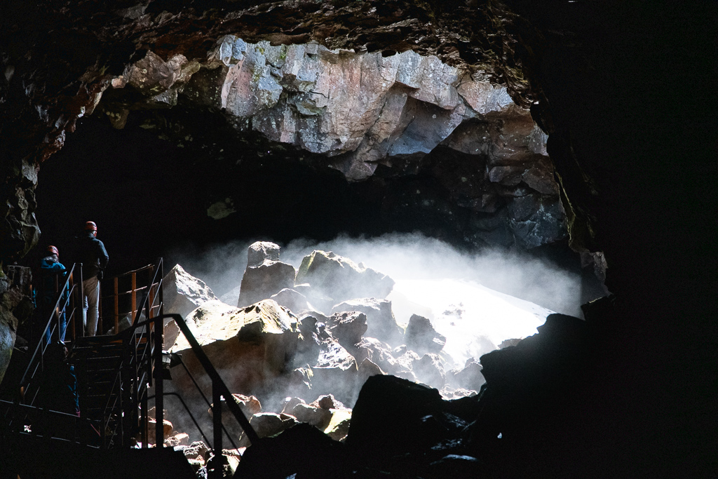
The Lava Tunnel in the Raufarholshellir area found us in hard hats exploring a long natural tunnel deep into the ground marvelling at the colours of the rock and lava in various shades of emerald, ruby, turquoise, and lilac, dyed by the mineral deposits. One quite unique moment occurred when our guide asked us all to extinguish our torches plus the tunnel lights were switched off. We then experienced what it was like in an environment where absolutely NO light existed. It was eerie, particularly as no visual reference point was available, only sound and touch.
Cruise resources and agenda
Resources
Adventure Canada puts on an excellent program with some very professional and enthusiastic people. This trip was no exception. Some examples:
- Lynn Moorman: a geoscientist and geomorphologist; is in the Department of Earth and Environmental Sciences at Mount Royal University in Calgary
- Deanna Leonard-Spitzer: grew up on the shores of Great Slave Lake and is now a marine biologist with Norway’s Institute of Marine Research (her whale lecture was excellent)
- Aaron Spitzer, Deanna’s husband, is an Adventure Canada historian and political scientist (and their son, Mark an aspiring Adventure Canada staffer)
- Greg Stroud: a botanist and birder from Newfoundland and was a naturalist with Parks Canada
- Dawn Bazely: biologist and prof at York University
- Mark Terry: a climate action specialist and Adjunct Professor at York and Wilfred Laurier
- Trausti Gunnarsson: a native of Iceland, naturalist and a professional wildlife guide
- Steve Burrrows: an ornithologist and author
- Svanur (Swan) Thorkelsson: an Icelandic storyteller, poet, and bard
- Gunna Lara Palmadottir: a tour guide and travel planner in Iceland
- Tyler Yarema: a talented piano player, singer and composer
- We were also joined by Lin Ward and Al Pace, owners of Canoe North Adventures, along with Beth Grant, who all encouraged us to join the voyage
- The Adventure Canada operation was run by Matthew James (MJ) Swan; Scott McDougall was the assistant expedition leader
Agenda
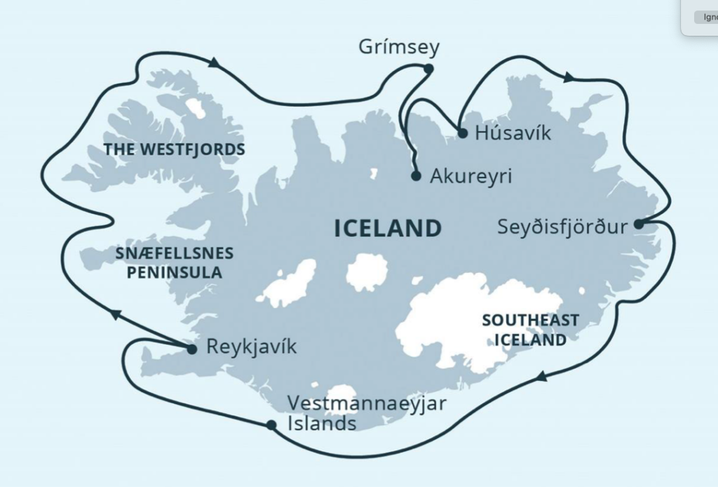
Day 1 (Tuesday, July 4): Reykjavik
We boarded our ship, the Ocean Endeavour and settled into, by our own request, the same cabin as we had for our Northwest Passage trip the previous September. We were underway after dinner, heading clockwise around this island country.
Lectures were presented on the Icelandic language (a combination of North Germanic Group and Old Norse) then one on whales (they can dive to 2000’, hold their breath for two hours or more, have large spleens, a lot of blood and collapsible rib cages, and superb senses such as “seeing” through ultrasound).
Day 2 (Wednesday, July 5): Arnarstapi, south Iceland
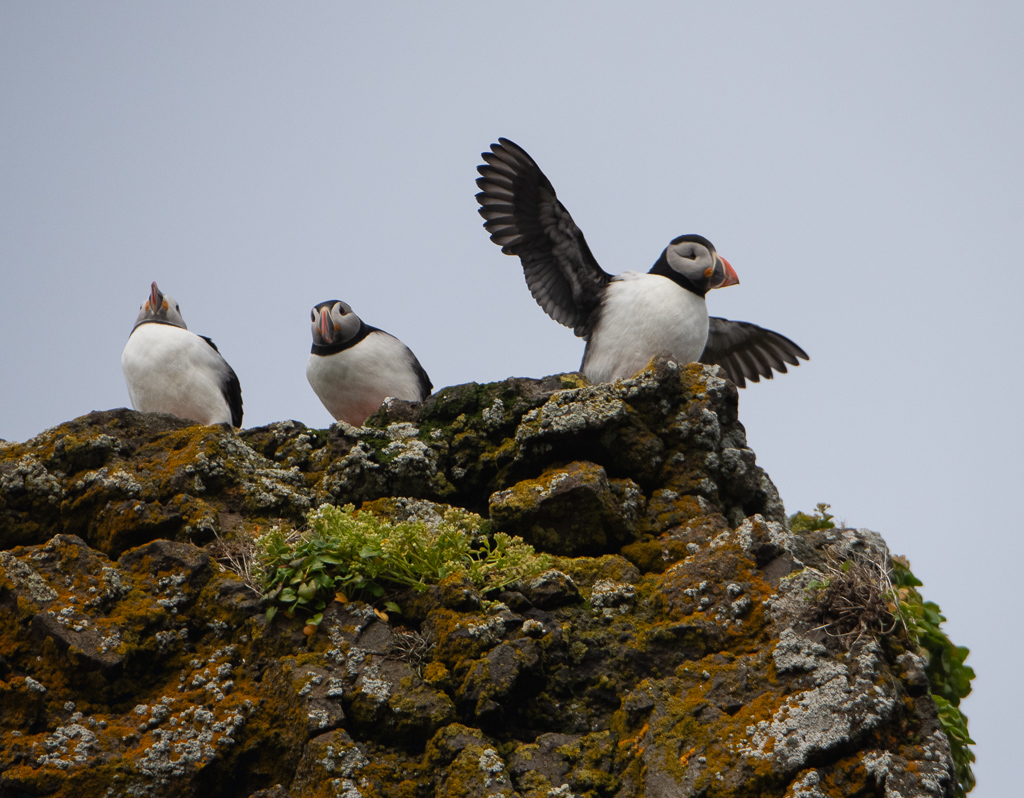
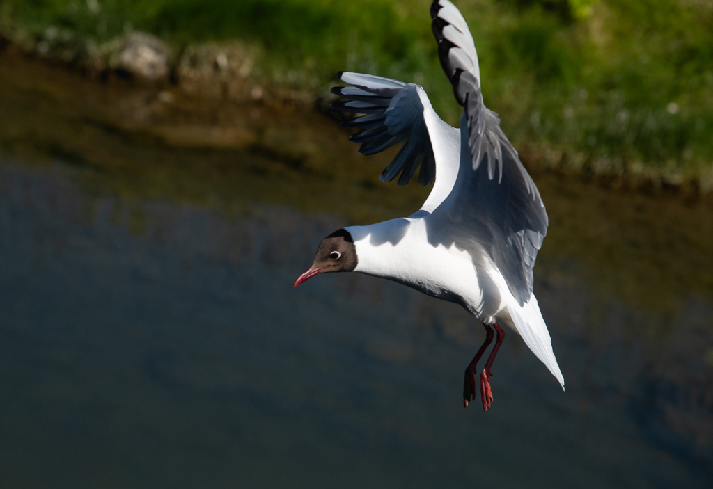
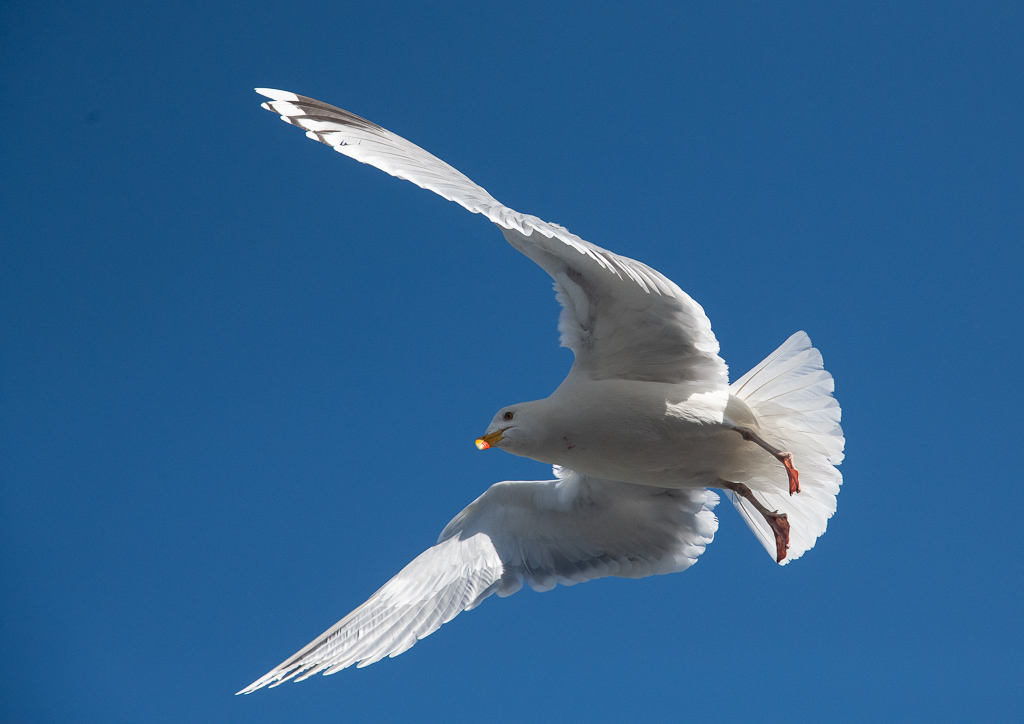
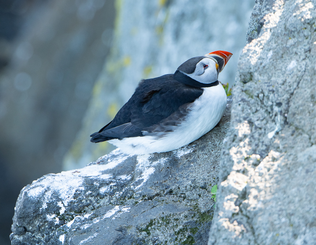
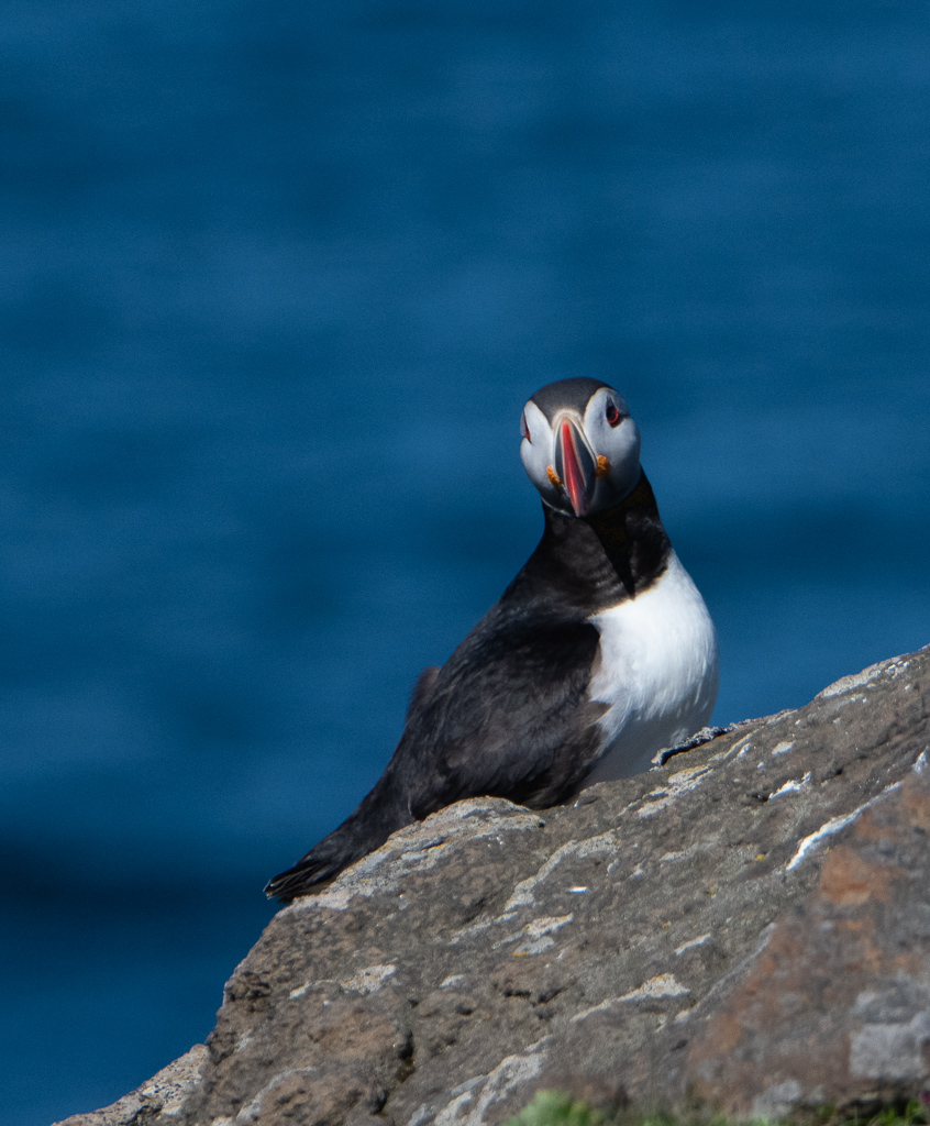
I chose to be with the birders on my first shore excursion, at Arnarstapi on the Snaefellsnes Peninsula. They sure are keen on identifying species, and hung quite close to the professional guide Greg Stroud, trading quips on distinctions between one year-old and two year-old plovers, and all manner of delights. In our brief hike we identified many birds – kittiwakes, skuas, guillemots and Atlantic puffins.
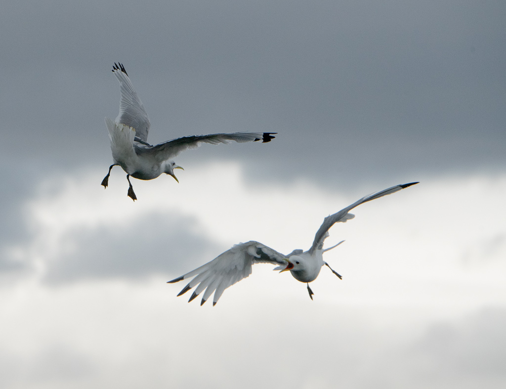
Summer is excellent as many birds nest plus migrating species have come to breed. Over the course of the journey 26 varieties were identified, including white wax tail, redwing, rock ptarmigan, northern fulmar, snipe, raven, golden plover, Arctic tern, common eider duck, common murres, kittiwakes, razorbills, gulls. My photos captured some of them, including two Arctic terns battling it out!
The shore line here is spectacular. The waves pound in against a dramatic, eroded circular stone arch, called Gatklettur, with the birds flying in and out of their nests perched on the cliffs.
The return zodiac trip pounded through high waves and the salty spray. Minke whales were spotted off the bow before supper.
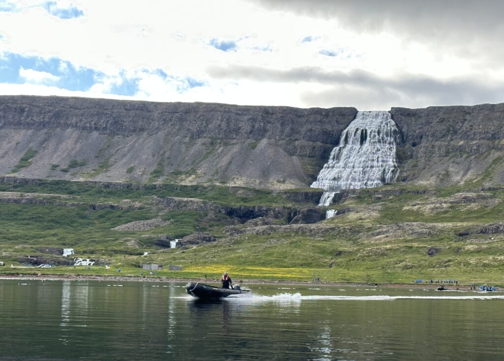
Day 3 (Thursday, July 6); Dynjandifoss, (the Westfjords)
Off on the zodiacs to land on shore for a hike to a series of seven beautiful waterfalls, with the big one, the 100 metre high Dynjandifoss (which means “thunderous waterfall” in Icelandic), all fed by surface, not glacial, water. As one looked around you could see many layers – each from a simple eruption of massive lava flows 12 million years ago, with 5 to 12,000 years between each eruption, causing the “steps” formation.
Learned that the crazy Arctic terns take 40 days to fly up from the Antarctic; they apparently spend the most time of all birds “in the light” – wintering in the Antarctic and summering in the Arctic.
Day 4 (Friday, July 7), Grimsey Island, then town of Siglufjordur
We’re now sitting right on the Arctic Circle (this makes Iceland part of the Arctic, along with seven other countries). 58 people live on this island, along with over one million sea birds, that’s 40 kilometres off the north coast of Iceland and the northernmost inhabited territory in Iceland. We headed off to a lighthouse at one end of Grimsey Island and a walk to the cliffs to photograph the nesting puffins. Then we cruised along in zodiacs to see the cliff life from the sea.
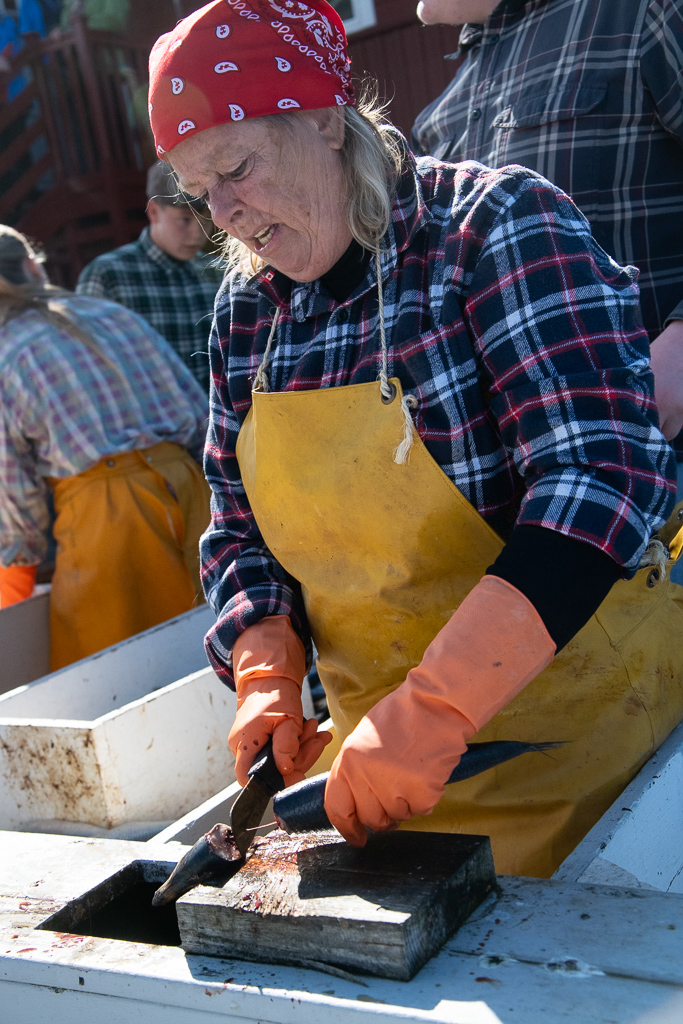
In the afternoon in the harbour of the small fishing town of Siglufjordur a group of locals, at the Herring Era Museum, re-enacted the “salt show”, i.e. the process of dealing with the herring brought back by the local fishing boats (much also to the delight of the local seabirds picking off snacks). They filleted then packaged the result into bags for future use. In the third factory we visited we were offered a taste of the herring along with a sip of aquavit flavoured with cumin. The foundations of the British and Dutch empires are considered by many to have been built on the herring fisheries and trade.
There were wonderful stories told about the “herring girls” who brought wages up and increased respect for the female worker (who often worked 18 hour days on piece-work wages). The town used to be the centre of the herring fisheries in Iceland, and the herring played a very large role in the nation’s economy, providing as much as 44% of the export income. But they (along with Norway and Russia) overfished it and the herring disappeared.
After dinner Tyler Yarema, who was incredible on piano (blues, and everything), and Chris on guitar played in the lounge. Lynn Moorman also sang beautifully.
Day 5 (Saturday, July 8): Akureyri, the hub of north Iceland
We anchored near the town of Akureyri at the end of the long Eyja Fjord – the longest one in Iceland. We were transported from this very natural harbour to a lovely brand new spa – Forrest Lagoon – where we floated around with silly smiles. Penny and I tested the cold pool. It was in and fast out.
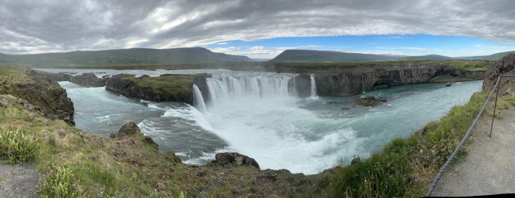
In the afternoon we bussed to a spectacular 40 feet high (and 100 feet wide) waterfall called Godafoss. The lava covering most of this valley is older than 8,000 years. There is a glacial river (Skjalfandafljot) flowing 180 kms from the source glacier. Salmon reach the falls and get stopped.
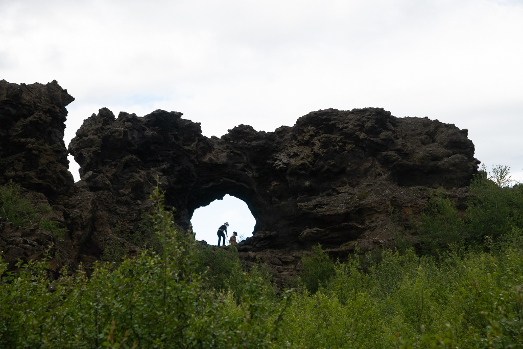
Then we dashed off to Lake Myvatn which is located at the intersection of the constantly drifting apart tectonic plates of America and Eurasia, which are volcanically active. We encountered a land of lava pillars, caves, and towering rocks, called Dimmuborgir. Alien, unearthly towers, some of them 70 feet high, were formed by steam explosions when the lava flowed into the ancient lake. They are 2,300 years old. The lava field formed the lake and its surroundings. These magnificent geological formations are rarely found on land.
Day 6 (Sunday, July 9): Húsavík, on north coast
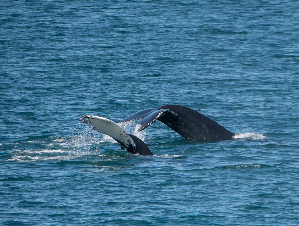
We hiked into and through the town of Húsavík on the north coast of Iceland. The town was the first place to be settled by a Norseman, around 870 AD. After visiting the wooden church built in 1907, we visited the whale museum which my deceased school buddy from Ridley – Peter Beamish, the “whale man from Newfoundland”, would have found fascinating, as it contained everything “whale”.
This led to an afternoon on an old crab boat searching for whales. We were rewarded with many clear sightings of, in particular, humpbacks – blowing, diving, a pair swimming side-by-side, and one executing a “lob-tailing” maneuver.
Day 7 (Monday, July 10): Seydisfjördur then Scalanes – eastern Iceland
We landed at the main dock of the town of Seydisfjordur with its multi-coloured wooden houses and were bussed over a 600 metre high mountain pass (occasionally through dense fog) to the Vallanes Organic Farm. It is the first of its kind in Iceland. They grow vegetables, tomatoes plus a lot of barley. The shop and cafe is built out of wood from the farm.
In the afternoon we took a long bus then into a 4 x 4 bus ride over three small rivers, first of all to a small grave site where some Christians were buried in a traditional fashion (aligned N/S, hands on chest, etc.) and then on to a reserve and viewing area for cliff birds. The Skalanes Nature and Heritage Centre is on a peninsula about 17 kilometre east of Seydisfjördur. The reserve is full of native plants and a wide range of wildlife. Great opportunity to see eiders and puffins nesting. The pesky and protective Arctic terns were dive bombing us all the way, as they had young exposed on the ground (they eschew nests). On the return we witnessed the area where huge landslides occurred in 2020, wiping out 13 buildings.
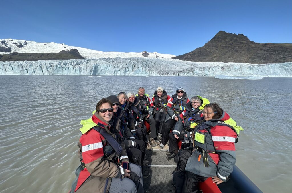
Day 8 (Tuesday, July 11): Breidamerkursandur glacier; Jökulsárlón glacier lagoon; Djupivogur village – southeast Iceland
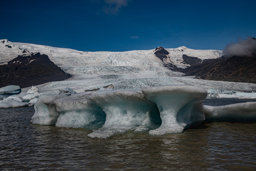
Up and off before 6 am for a long bus ride to the Jökulsárlón glacier lagoon (Iceland’s most famous) about 370 kilometres southeast of Reykjavik. We climbed into zodiacs and cruised around this small lagoon that formed at the bottom of Iceland’s second largest 1000 m thick glacier, which is receding quickly with the earth’s crust bouncing back up. Behind is the Kviarjokull glacier.
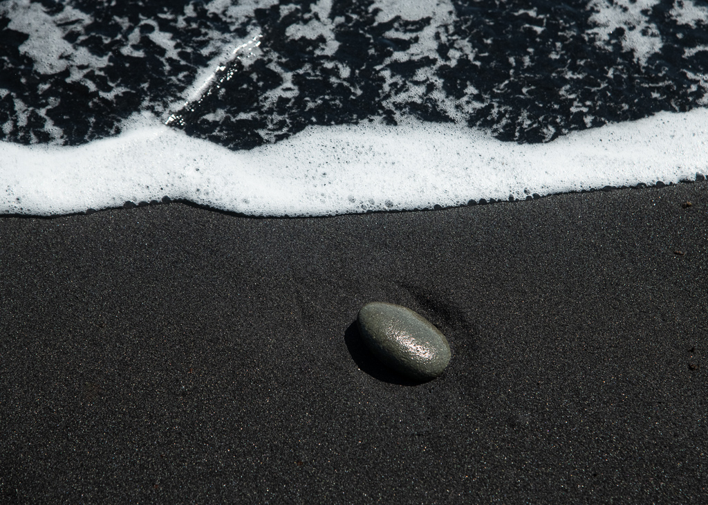
A walk on nearby Diamond Beach was fascinating as the pitch black basalt ash (or “sand”) contrasts with the sea pounding in against the slowly diminishing ice flows heading out. Occasionally “sneaker” waves have been known to sweep people off these beaches.
The history of the glacier tells a lot about the challenges the world faces environmentally. At the time the first settlers arrived, the edge of the Breidamerkursandur, an outlet glacier of the greater glacier Vatnajökull, is thought to have been around 20 km further north than it is now. In about 1200 AD the climate began to cool to a peak in the period 1600-1900 (the Little Ice Age). As a result this glacier advanced until around 1890, reaching a point only about one kilometre from the coast at Jökulsa river. The eastern part of the glacier eroded the sediments of Breidamerkursandur to a depth of 1,000 feet below sea level. A warm period from 1920 to 1965 caused great changes in the glacier. It retreated very quickly, leaving a lagoon up to 600 feet deep and it doubled in size from 1975 to 1998. Now large blocks of ice break off the edge of the glacier, which is around 100 feet high, keeping the lagoon stocked with icebergs.
The strip belongs to the greater Breidamerkursandur glacial plain, located by the Jokulsarlon glacier lagoon. Both glaciers are among the 30 outlets of Vatnajokull, Europe’s largest ice cap and the central feature of the Vatnajokull National Park. But the caps are melting at a fast rate, so within decades may no longer exist.
Day 9 (Wednesday, July 12): Heimaey Island and the Surtsey eruption, on south coast
After a lecture on “Climate Action” by Dr. Mark Terry we witnessed the dramatic entrance into the harbour of Heimaey or Home Island (the biggest and only inhabited of the Westman Islands situated 4 nautical miles off Iceland’s south coast). I felt I could touch the tall cliffs on the starboard side; on the port side, we were to learn, was the overflow of Eldfell volcano that erupted in 1963, destroying one fifth of the town and nearly closing off the harbour, leaving a quite narrow entrance. An operation to cool the advancing lava with sea water saved the town and harbour. The local Eldeheimar Museum was built around a house that was swallowed up by the Surtsey eruption and excavated from the lava!

Our tour guide was the vice principal of the local school, who extolled the virtues of living on an island (only 4,500 do) that is a three hour boat ride from the mainland. (“Our sports teams are determined, resilient and tough.”) It’s a windy place – on one of the outer islands they were clocked at 176 mph. We drove around the cliffs in our zodiacs, saw Elephant Rock (this natural formation looks like the head of a giant elephant and the basalt formation looks like his wrinkled skin) and then into a massive cave. Millions of puffins visit the island every summer, plus millions of other birds migrate there to feed and breed.
In the evening we learned of the new volcano that is erupting about 30 kilometres SW of Reykjavík. Apparently, as they say, “it’s the Fagradalsfjall Volcano system awakening again”. It’s occurring in the Reykjanes Peninsula and sits atop the continually spreading Mid-Atlantic Ridge where the two plates are pulling apart. Superhot, gassy magma, which is less dense than the surrounding rock, can sometime rise into the shallow crust from buoyancy alone. We could see and photograph the red flames, smoke and bubbling lava off in the distance. We tracked its progress over the next couple of days on the TV.
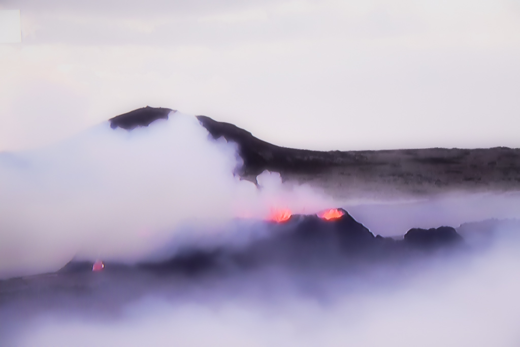
Note: as I was writing this, in the southwestern Reykjanes Peninsula, the town of Grindavik was being evacuated (November 12) because of another volcanic threat. Some volcanologists suggest that the peninsula was entering a new volcanic era. The peninsula went a staggering 800 years without seeing a lick of lava – until March 19, 2021 when molten rock erupted from a series of fissures. It stopped on September 18, but a second one began nearby 319 days later. It ended on August 21, 2022 but after 323 days a third one started as we were rounding Iceland’s eastern shores on July 10. And now this. The scientists are trying to figure out why the magma is coming out in these weirdly rhythmic pulses instead of erupting all at once.
Day 10 (Thursday, July 13): Reykjavík
Disembarkation and back to the hotel we first used, one quite close to the port. Off to the amazing Perlan Museum, where a surround theatre in the planetarium immersed us in a visual journey through the landscapes of Iceland in its aurora borealis splendour. We then walked through the recreation of a glacial ice cave, and then around the Perlan glass dome on the roof, from which we could see all of Reykjavik, as well as the new volcanic eruption.
The uniqueness of Iceland
So from this wandering around the interior and circling the exterior, what kind of brief summary can be made?
- breathtaking views that look like oil paintings, that include mountains, glaciers, volcanoes (35 active), lava fields, obsidian rocks, hot springs and craters, massive waterfalls, black sand beaches, glacial lagoons, and colourful, turf-roofed villages: a very diverse countryside; plus the Northern Lights
- natural wonders like the myriad hot springs seem to appear out of nowhere and are a staple of virtually every town in Iceland; apparently 800 of them
- the island of Iceland was pushed up above the ocean between eighteen and sixteen million years ago. It is still creating itself: it is one of the youngest and most geologically active places on earth, with over two hundred volcanoes peppered along the rift between the North American and Eurasian plates which divide the country almost in half on a crooked northeast- southwest line. The eruption on the inhabited southern island of Heimaey in 1973 was especially dramatic. Earthquakes are frequent. The creation of new land continues and the island of Surtsey made headlines as it rose between 1963 and 1967
- volcanic systems: the Bardarbunga caldera is the centre of a large volcanic system, the largest in Iceland and one of the largest in the world. The volcano, hidden beneath the ice cap of the Vatnajokull glacier in the Central Highlands, is one of the two largest and most powerful volcanoes in Iceland. It has actually produced more lava in the past 10,000 years than any other volcano on Earth
- Iceland is much more than a country of volcanoes and hot geysers, however; 11% percent of the country is covered in enormous glaciers, the largest in Europe. As climate change melts glaciers worldwide, Iceland is losing nearly ten billion tons of ice every year, leading to its rebound against sea level of over fifteen centimetres since 1995
- the reality of the glaciers shrinking means the loss of ice, of water security, and of beautiful places and sights. In their retreat they leave vast carved out valleys. The stories of the valleys are the stories of the glaciers once there
- in 850, a Faroe Island resident, Naddoður, drifted off course on his way to Norway and spotted Iceland’s eastern shore. In the following years, other Norsemen visited Iceland and explored the possibilities of settling there
- Iceland is the only country in the world that can claim to obtain 100% of its electricity and heat from renewable sources. The glaciers and rivers of the interior are harnessed to generate 80% of the country’s electricity needs through hydropower, while the geothermal fields provide up to 20% of the country’s electricity needs. 86% of houses use geothermal water, but it has a lot of sulphur
- sheep wander free, only to be collected up according to their markings in the late fall
- there are no natural predators, except the Arctic fox. A few reindeer roam about. There are no bats, rabbits, frogs, snakes, or mosquitoes. Then there is the Icelandic horse with the normal four plus one gaits. The rest of the animal kingdom exist in the air (birder heaven) and the sea (whale, seal, dolphin, porpoise).
- at the time of human settlement, vegetation covered 65% of Iceland, much of which was birch wood forests, but now 85% of their forests are gone; there is little vegetation. Settlers cleared most of the woodland to create pastures and hay fields. A standing joke goes “What do you do when you get lost in an Iceland forest? Answer: Stand up!”
- we were told many locals believe in elves (probably a cultural leftover from their shamanistic heritage), just like the quirky Irish and their “little people” (my Irish mother believed in them!)
- the population moved from Norse polytheistic paganism (Vikings and the Norse gods Odin and Thor were prominent; as heathens they believed in Valhalla, so were proud to die in battle) to Christianity imposed by the King of Norway in 1000 AD. Thus they were Roman Catholic until 1550 when it became entirely Evangelical Lutheran (98%) imposed (that word again!) in 1550 by King Christian III of Denmark and Norway, following the beheading of the last Icelandic bishop; currently now ~70% are defined as Christian
- it was originally settled by the Norse and Celts and later controlled by Denmark, and thus has no Indigenous population (thus no history of colonial oppression and looting)
- it was a time capsule for the Nordic “golden age.” It had been settled and subsequently cut off from Europe, preserving its “perfect” people in isolation
- Icelanders rarely get cavities because of their fish-based diet
- most workers are unionized (over 90%); most work in tourism, fishing and aluminum smelting. Then in 2008 an economic crisis (their króna plunged 70% before all currency trading was suspended; the domestic stock market shed 90% of its value; the country was essentially bankrupt). Since then the government has been trying to diversify the economy
- it has been a country with hard times: 1707 the Black Death (bubonic plague) killed nearly a third of the population; in 1783-4 the Laki Eruption caused widespread destruction and killed more than half of its domestic animals, resulting in a famine that killed nearly a quarter of its human population. The difficulties of living caused nearly 20% of the population to emigrate, mostly to Canada, at the end of the nineteenth century
- it is expensive; gasoline at $9/gallon, the third highest in the world; taxis are limited and charge extreme rates; our normal sized hotel room was over $400/night; a dinner usually exceeded $200 per couple (wine is in that number)
- the first car was introduced into the country as late as 1913
- the Icelandic language presents problems, in my opinion, for the country in tourism terms. I’ve tried to remember some of the spots I was impressed with, but when confronted by 13 plus letters and many unusual combos (for my ear) I default to some description instead. So (just saying) they might consider renaming their attractions. It has already started, as in Golden Falls, Blue Lagoon and Lava Tunnel. They have farther to go.
England (brief summary)
Reading, Berkshire area
The next day we rose at 4:15 am to catch an Iceland Air flight to Manchester, England, rented a 4 door MG and over the next week drove just under 600 miles to visit my relatives near Reading 60 km west of London and Penny’s brother in Nottingham.
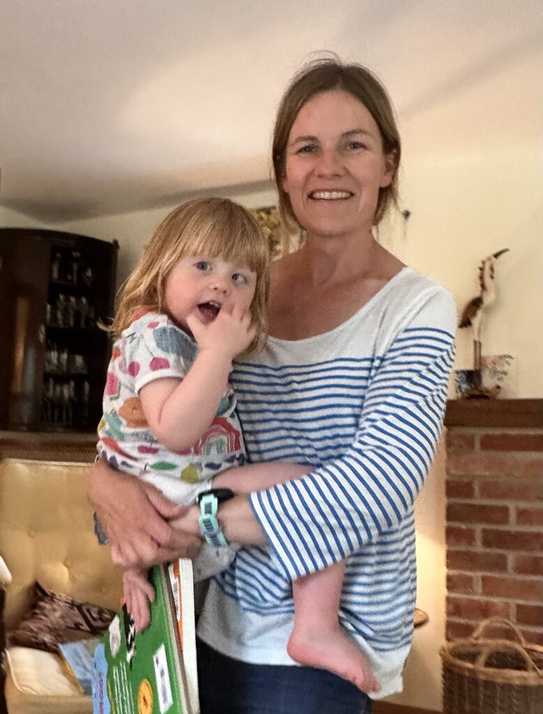
The traffic was heavy and weather quite rainy, so our 200 plus mile drive south around and past Birmingham and on to Midgham Green near Reading took about five hours. We stayed with my cousin Michael Powell and his wife Hazel, both retired doctors, at their home called Water Oak (the west wing is vintage 1570 with an oak tree on the corner of their property the same age). We didn’t arrive until around 8 pm. Their daughter Sophie, also a doctor, was with her newly adopted Aurora, a very cute and all-focus-on-me two-year old girl, along with my cousin Carolyn Powell, were also staying at their home.
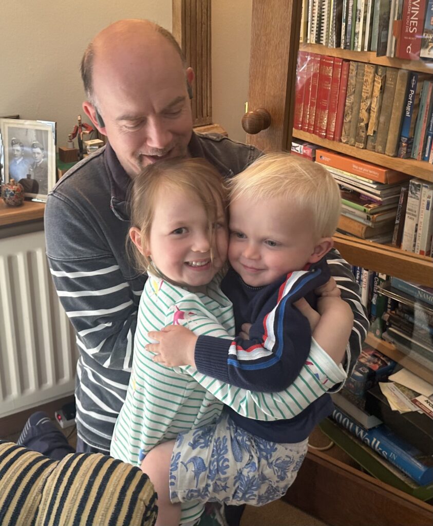
After a glass of wine, we all drove over to the home of another cousin, Annabel and her husband Roger Williams (also both doctors), plus their daughter Sammy, a vet, and her husband Ian Shaw and their two children, Meredith and Arty, for a quite wonderful full course meal around 10 o’clock. Remember this is all the first day post Iceland!
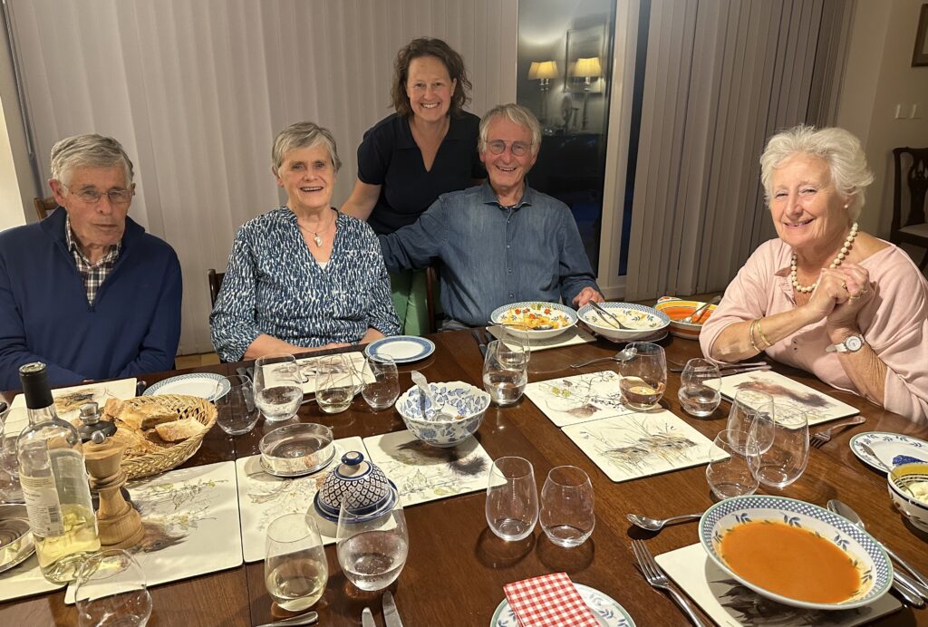
The next day a huge lunch took place back at Mike and Hazel’s with the same gang plus their son Chris and his son Charlie, joined us. As always, everyone talked at the same time.
The next day Mike and Hazel took us for a ride in their boat along the Thames River up to and under the Whitchurch Toll Bridge, which was first built in 1792 and owned by a private company with powers to collect tolls to pay for the bridge. There was lots of action on the river: fishing, rowing, canoeing, boating and birds, and even a swimmer. This was the first journey in the boat since a new engine had been installed after the boat sunk in a huge rain storm last year; it performed well.
Nottingham, Nottinghamshire, East Midlands
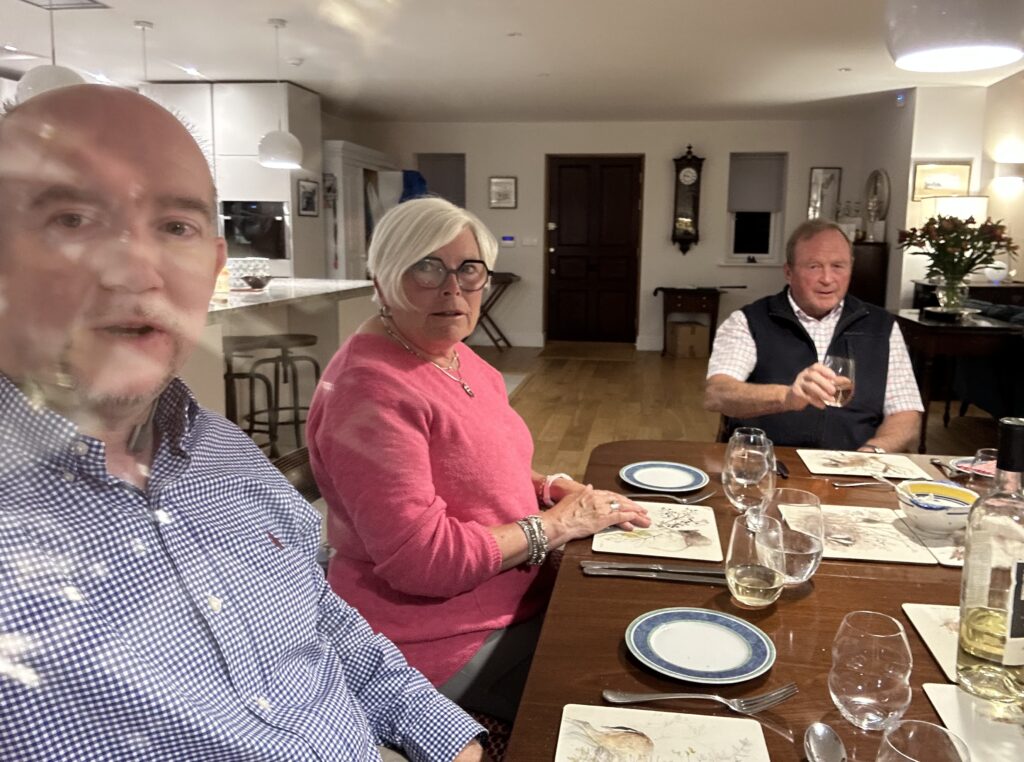
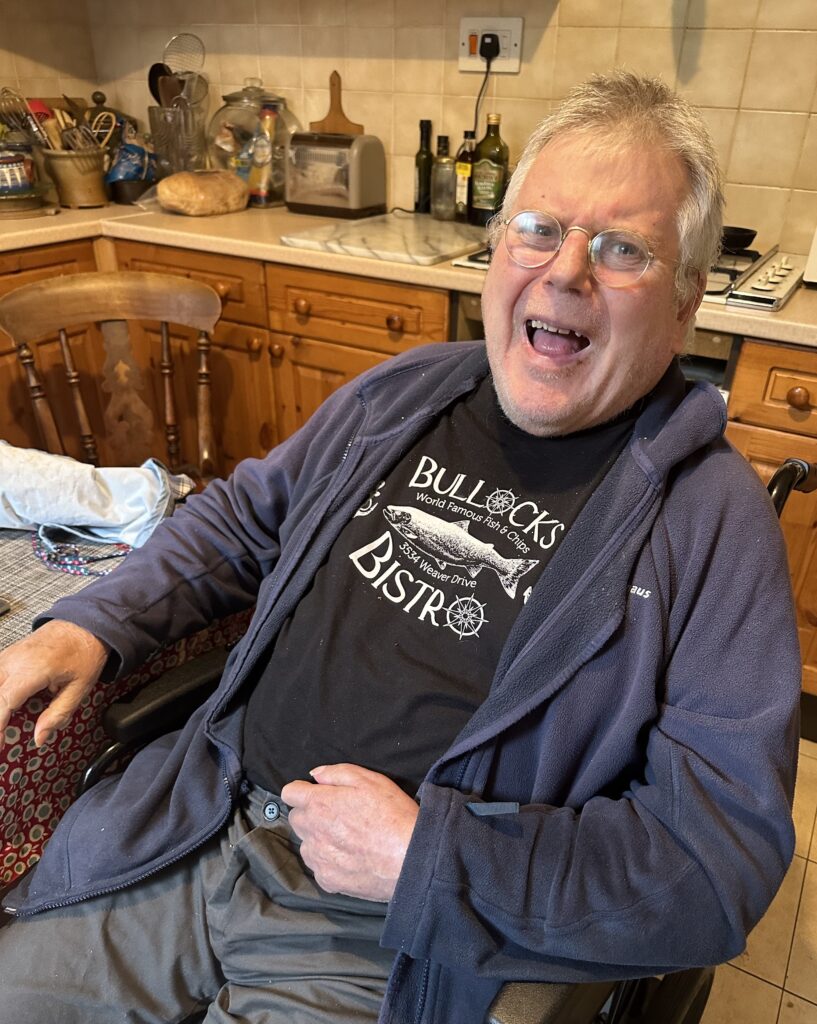
We then drove about 120 miles north to visit with Penny’s brother Chris Sayers in Nottingham. It was delightful to see that Chris’ off-beat sense of humour remains, and that he still loves a good story. He seems to handle the consequences associated with the stroke plus cerebral bleed he had back in 2008. We stayed in a boutique hotel in the centre of Nottingham, Hart’s Hotel, and visited with Chris each day until his care givers prepared him for the evening. The hotel also had an excellent restaurant.
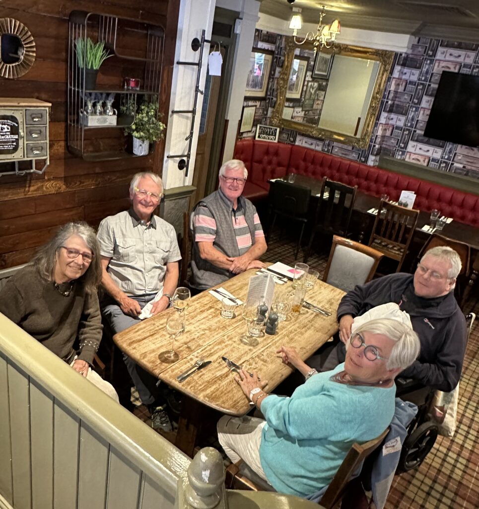
For one lunch we drove Chris to a pub connected with the Nottingham Cricket Club, called Larwood and Voce. We were joined by Penny and Chris’ first cousin Trish and her husband Tony Williams. Lots of family stories were exchanged.
We then drove back to Manchester, stopping for lunch in the charming Derbyshire village of Cromford, at the southern tip of the Peak District. Lots of narrow stretches, winding turns, hills and pleasing vistas – an area that we’ve enjoyed driving through in the past. I have photos of cows, sheep and tractors. We stayed near the airport and flew home the next morning.
Again, to find additional photos, go to this link for both Iceland and England images: https://photos.app.goo.gl/7aRBQJgpuuB7ciXW7.
Thanks Ken. You will be pleased to know I read every word, ( not my usual style).
Enjoyed every part , keep traveling, keep me entertained.k
Hi KEN
I am in your third category of curiosity !
I loved your descriptions of Iceland and the photos .We had a Coroners trip there a few years ago ,while on a 3 day stop over going on to Scotland .
I wanted to meet with local coroners ,and made contact with a member of their judicial system to explore setting up such a meeting .When I described what the Ontario Coroners system was set up to investigate ,he said there was no Icelandic equivalent as there were so few homicides and sudden unexpected deaths were mostly involved with the fishing industry .The authorities for this government controlled industry did the investigations and were not interested to talk to us !
The only stiffs we encountered were in the Museum of Phallology where you would have found a photo of our Coroners touring group on a wall !!
You were obviously distracted while visiting this place .
We also enjoyed The Blue Lagoon ,the unique Iceland ponies and looking for Trolls
under all the bridges .
I should show you my pictures some time .I would be disappointed if you placed yourself in category 1 ,as an elevator enquirer ..
See you around
Cheers
Don
Enjoyed the read. Thanks
Fascinating! Really enjoyed learning more about Iceland than we didn’t know we didn’t know!
Bob and Patti Penny
Thanks Ken for putting together such a wonderful recap of our Icelandic voyage. As usual I enjoyed reading about your adventures. Hope you had a wonderful Christmas and all the best for a happy, healthy 2024 to you and Penny.
Having visited Iceland a few years ago (but mostly around Reykjavik) this was a wonderful sentimental journey back – but with many more interesting facts and details. Thanks as well for the gorgeous photos. (I was wondering if the aviary closeups were done by Ken.)
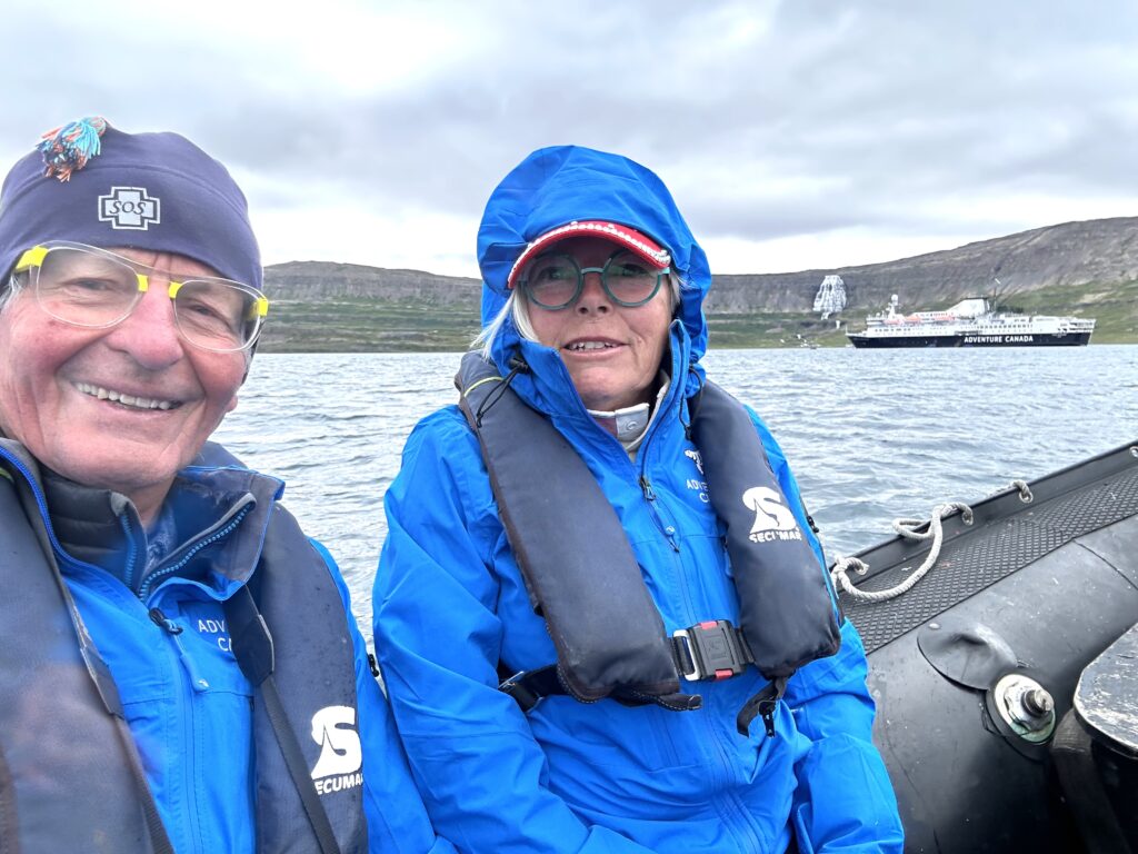
All photos are done by Ken, including “aviary closeups”!